
Generate 3D Models from Drone Photos — Build Temperature-Colored (Thermal) 3D Models with CRITIR
Learn how to automatically generate 3D models of buildings and structures from drone or ground-camera photos. With CRITIR, you get a visible-light 3D model plus a temperature-colored thermal 3D model, all linked to measurements and report output — streamlining inspection documentation for complex facades, equipment, and solar panels.
Key Points
- 3D model generation estimates camera positions from multiple photos and reconstructs the 3D shape of the subject.
- Shapes that don't fit a flat orthoimage (uneven surfaces, complex structures, three-dimensional equipment) can be represented correctly in 3D.
- With CRITIR, you get a visible-light 3D model plus a temperature-colored "thermal 3D model" — generated automatically.
- Linked to measurements and report output: one measurement is reflected on the 3D model too, streamlining inspection documentation.
What Is 3D Model Generation?
3D model generation (photogrammetry) reconstructs the 3D shape of a subject from multiple photos. Broadly, it works as follows:
Photos → Camera pose estimation (SfM) → 3D point cloud → Mesh (surfaces) → Texture projection- Feature matching: extract and match common feature points across images
- Camera pose estimation (SfM): back-solve the position and orientation of each image
- Mesh construction: reconstruct the 3D surface from the point cloud
- Texture projection: project each image onto the surface to apply appearance
While an orthoimage projects everything onto a single reference plane, a 3D model retains the shape itself in three dimensions — so even complex shapes that don't fit a plane are faithfully represented.
Why 3D Models Help in Inspection
For most façade and equipment inspection documentation, an orthoimage (a plane image equivalent to an elevation drawing) is enough. But for some subjects, forcing everything onto a plane breaks down:
- Structures with large relief (beams, piping, tanks, steel frames)
- Three-dimensional equipment where multiple faces interweave
- Subjects mixing curved and sloped surfaces
Forcing such shapes onto a single plane creates parallax ghosting and distortion. A 3D model preserves the shape correctly and lets you survey the whole from any angle.
CRITIR's 3D Model Generation
CRITIR is inspection-focused software specialized in thermal and visible image analysis. It generates 3D models from your photos automatically, without difficult setup.
- Automatic from photos: estimate camera poses from visible images and reconstruct the 3D shape
- Handles complex shapes: relief and three-dimensional structures that are hard to render as a flat ortho
- Runs without a GPU: a supported GPU accelerates processing, but lightweight mesh generation works on non-GPU PCs
See Temperature in 3D: the Thermal 3D Model
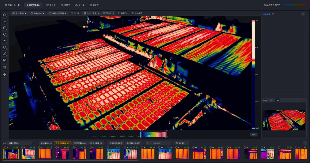
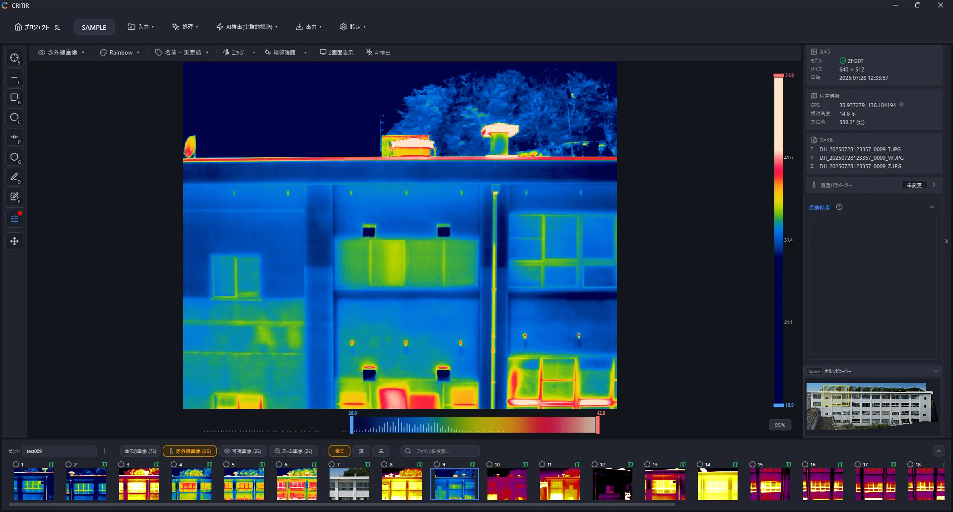
CRITIR's standout feature is generating not just a visible-light 3D model but a temperature-colored thermal 3D model. The temperature data from simultaneously captured thermal images is projected onto the 3D shape reconstructed from the visible images.
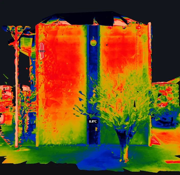
A flat thermal ortho only shows the temperature distribution from one direction. A thermal 3D model lets you rotate freely and inspect the temperature on every face. Even for equipment with complex shapes, you can intuitively see which face is hot and where.
Measurements Are Projected onto the 3D Model Too
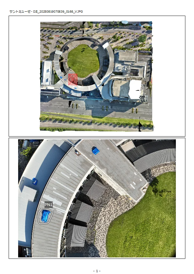
In CRITIR, the measurement points you place on one image (temperature readings, degradation regions) are automatically projected not only onto orthoimages and CAD drawings, but also onto the 3D model.
- A measurement placed on one image appears at the same position on the 3D model, in three dimensions
- No need to repeat the same work — it is reflected across all views at once: the source image, other photos, ortho, CAD drawings, and the 3D model
- Grasp the spatial relationship of anomalies intuitively within the 3D shape
Linked to Report Output and Other Views
The generated 3D model does not stand alone — it works together with CRITIR's other features.
- The HTML viewer export can bundle the 3D model, so you can rotate and browse it in a browser while reviewing measurement results
- Combined with orthoimages, measurements, and drawing projection, it integrates into report templates in one stop
The 3D Model Workflow in CRITIR
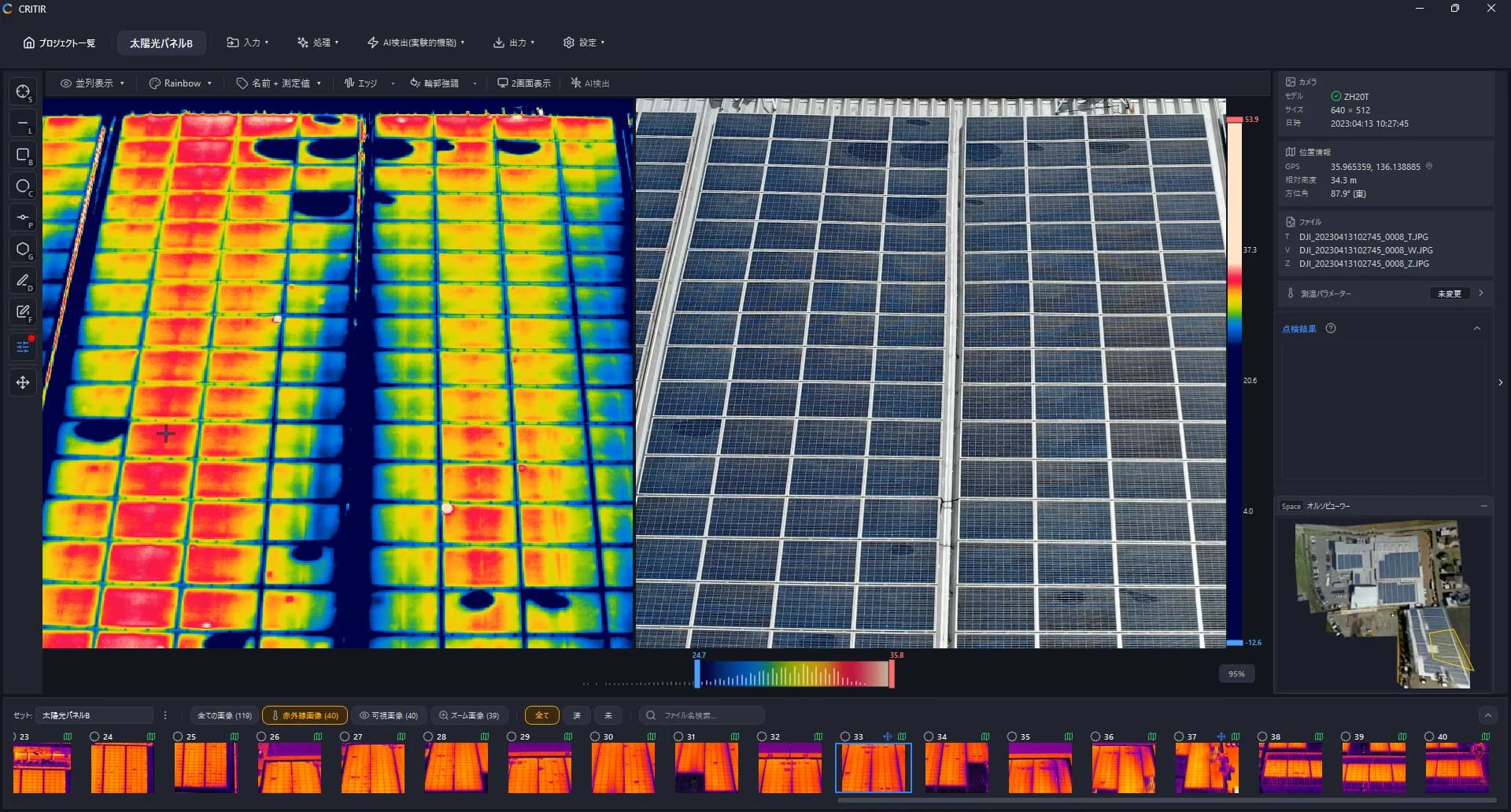
Creating a 3D model in CRITIR takes these simple steps:
- Capture: shoot the subject from multiple angles with a drone or ground camera (visible + thermal)
- Import: load the images directly into CRITIR
- Run 3D generation: estimate camera poses and reconstruct 3D — producing both a visible-light and a thermal 3D model
- Measure & report: place measurements/degradation regions on an image → auto-reflected on the 3D model and every view. Generate the report directly
Ideal Use Cases
Solar Panel Inspection
At mega-solar sites where mounts and arrays are arranged three-dimensionally, a flat ortho alone may not capture the tilt and layout of the faces. A thermal 3D model lets you survey the distribution of hotspots and anomalies across panel faces in 3D.
Equipment and Plant Inspection
Piping, tanks, and steel frames — three-dimensional equipment with large relief — are where 3D models shine. Rotate to see which face is hot and where.
Façade and Structure Inspection
Even for buildings and façades with complex shapes, a 3D model preserves the geometry while you assess degradation and temperature distribution. Combined with flat orthos, you can build inspection documentation from both an overhead and a three-dimensional perspective.
How It Differs from Conventional 3D Reconstruction Software
General-purpose photogrammetry software such as RealityScan (formerly RealityCapture) and Metashape can build high-quality visible 3D models. However, as general-purpose reconstruction tools, their assumptions differ from inspection use:
- Not designed to carry temperature data: they can build visible-texture 3D models, but projecting thermal temperature data onto a 3D model is not a standard feature
- No linkage to measurement or reporting: they have no mechanism to reflect a measurement on the 3D model across other views or report templates
CRITIR is designed around real inspection needs, completing everything from thermal 3D model generation to measurement and report creation in a single tool.
FAQ
- What kind of photos does CRITIR need to generate a 3D model?
- You need a set of images shot from multiple angles with sufficient overlap. Drone or ground cameras both work. CRITIR reconstructs the 3D shape from the visible images and projects the simultaneously captured thermal images to produce a temperature-colored (thermal) 3D model.
- What is a thermal 3D model?
- It is a 3D model whose surface is colored (thermal colormap) by the temperature of each face. Unlike a flat orthoimage, it lets you inspect the temperature distribution of complex shapes in three dimensions, rotating freely.
- How is this different from RealityCapture (RealityScan) or Metashape?
- General-purpose photogrammetry software can build high-quality visible 3D models, but they are not designed to carry temperature information. CRITIR is built for inspection: it projects thermal temperature data onto the 3D model and links it to measurements and report output.
- Do I need a high-end PC to generate 3D models?
- A supported GPU speeds things up but is not required. Lightweight 3D mesh generation also runs on non-GPU PCs.
Conclusion
By generating a 3D model, even complex shapes that an orthoimage cannot fully represent are faithfully reproduced.
By specializing in inspection, CRITIR delivers:
- A visible-light 3D model plus a temperature-colored thermal 3D model, generated automatically
- Automatic projection of measurements, so you instantly grasp anomaly distribution on the 3D model
- Linkage to report output and the HTML viewer, building inspection documentation end to end
If you want to document complex-shaped subjects or inspect temperature distribution in 3D, feel free to reach out via our contact form. You can also find feature details in the documentation.
Published: July 7, 2026 / Last updated: July 7, 2026
Generate facade and wall orthoimages automatically with CRITIR
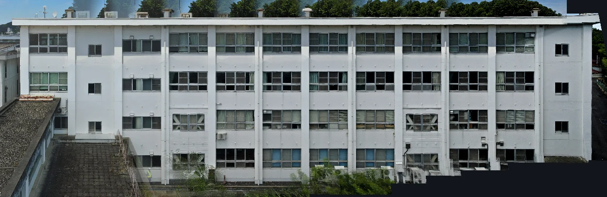
A clear walkthrough of how facade and wall orthoimages are built from drone or ground-camera shots, and how CRITIR simplifies the process. Where RealityCapture (RealityScan) and Metashape require significant manual work for vertical surfaces, CRITIR automates the pipeline — including thermal orthoimages — to streamline facade inspections and defect surveys.
Analyze Skydio X10 thermal images directly in CRITIR, no conversion needed
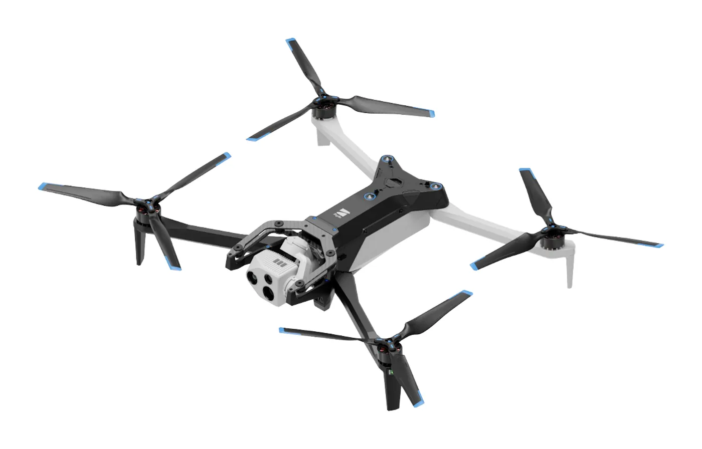
CRITIR now supports the Skydio X10 (VT300-Z payload). Read its FLIR Boson+ radiometric R-JPEG thermal images directly — no conversion — and run temperature analysis, facade orthoimage generation, measurement projection, and reporting in one app. Built for facade, solar, and infrastructure inspection workflows.
Analyze DJI thermal images directly in CRITIR, no conversion needed
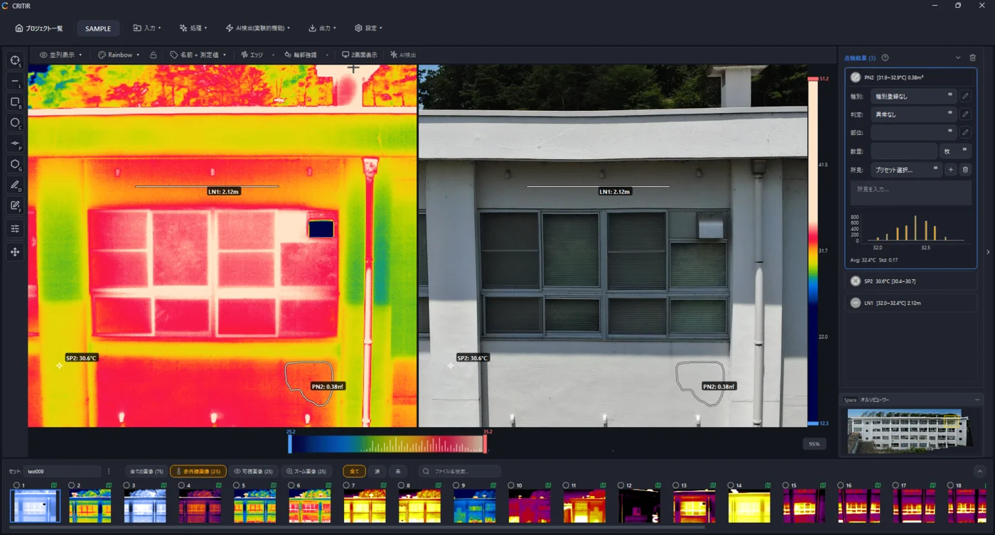
Skip the conversion step for DJI R-JPEGs. CRITIR analyzes DJI thermal images directly, generates facade orthoimages, and produces reports — all in one app. Cut the cost and time spent on converter tools and conversion services.